Click HERE to return to all rocks.
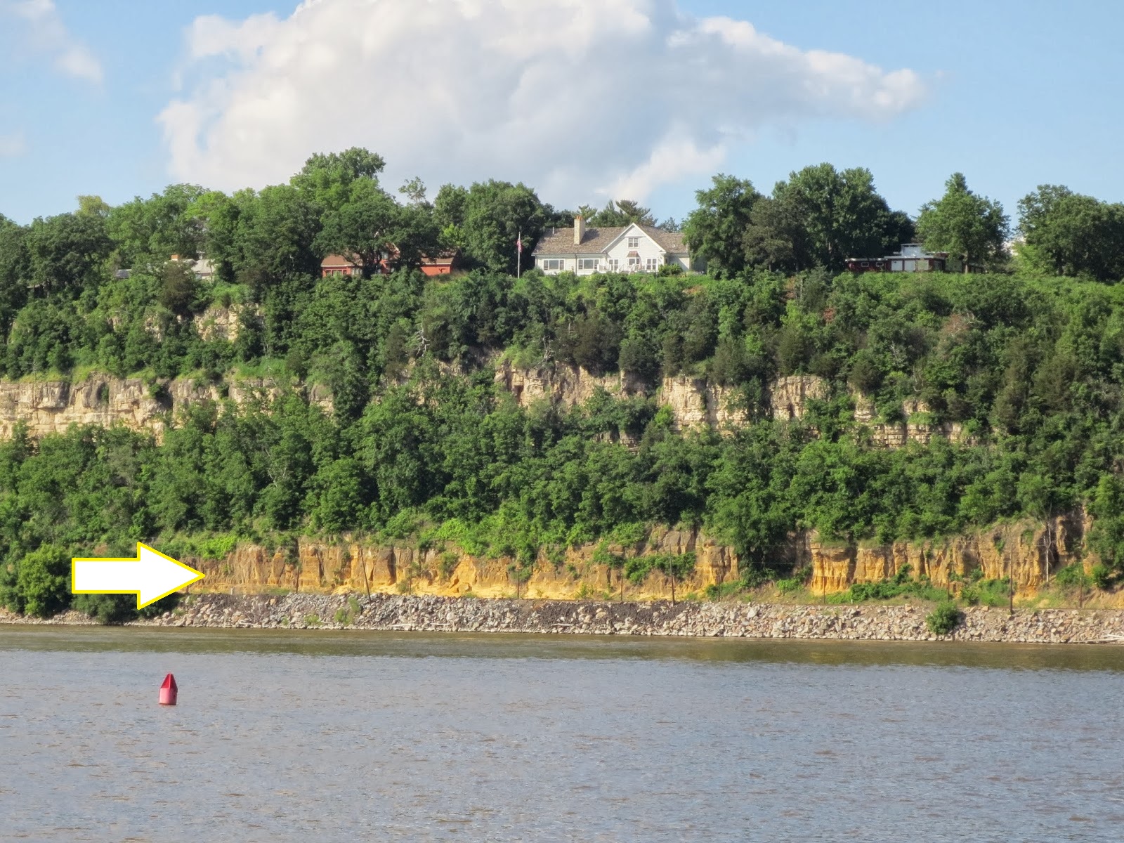
Photo of the Jordan Sandstone near Lock and Dam 2. Jordan layer is indicated with white arrow. Image credit: Justin Tweet, https://equatorialminnesota.blogspot.com/2014/02/practical-guide-to-mnrrametro-area.html 🗗
The Jordan Sandstone was deposited in the late Cambrian Period (493-491 Mya). It lies unconformably under the Prairie du Chien Group (that is, there is “missing time” between adjacent rock units). The Jordan is made of quartz sandstone and feldspathic sandstone +/- some shale and siltstone, and represents a regressive sequence (sea level falling as you rise in the unit).
The Jordan is spread over about 1,520 square miles in the Twin Cities metro area. It is over 100 feet thick. It can’t be seen in outcrop until you get to the river gorge near Hastings, where it is a couple tens of feet wide.
The Jordan Sandstone is a productive aquifer, and it has also been mined for frac sand. About 80% of the groundwater pumped in the Twin Cities comes from the Prairie du Chien-Jordan aquifer.
https://equatorialminnesota.blogspot.com/2018/01/practical-guide-to-st-croix-valley.html#more🗗
https://equatorialminnesota.blogspot.com/2014/02/practical-guide-to-mnrrametro-area.html#more🗗
https://www.pca.state.mn.us/sites/default/files/mm-overview.pdf 🗗